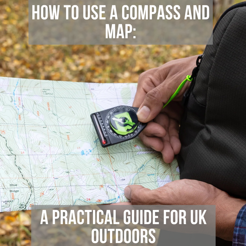
How to Use a Compass and Map: A Practical Guide for UK Outdoors
Posted by Heinnie Haynes on 17th Feb 2026
Estimated reading time: 14 minutes
In an age of GPS and smartphone apps, knowing how to use a compass and map remains one of the most valuable skills any outdoors person can develop. Batteries die, signals fail and technology breaks at the worst possible moments. A quality compass and paper map require no power, work in any weather and will never lose satellite connection in a remote valley. These fundamental navigation skills connect you to centuries of exploration and provide genuine self-reliance when venturing into wild places.
Why Traditional Navigation Still Matters
GPS technology has transformed outdoor navigation, but relying solely on electronic devices creates dangerous vulnerabilities. In the Scottish Highlands, the Lake District or Snowdonia, mobile signal can disappear for hours. Cold weather drains batteries rapidly. Drops onto the rock can destroy screens. And when conditions deteriorate and you genuinely need navigation, these are precisely the moments when technology most often fails.
A compass points north regardless of battery life. A map shows terrain whether you have signal or not. Together, they provide redundancy that could prove lifesaving. Even if you carry a GPS as your primary navigation tool, understanding compass and map work gives you a backup that weighs almost nothing and never needs charging.
Beyond practical safety, traditional navigation develops spatial awareness that GPS cannot replicate. Reading contour lines teaches you to visualise terrain before you see it. Taking bearings builds understanding of your environment. These skills make you a more confident, capable outdoors person, regardless of which tools you ultimately use.

What You Will Need
Successful navigation requires the right equipment matched to your intended use.
The Baseplate Compass
For UK hillwalking and general outdoor navigation, a baseplate compass offers the best combination of functionality and ease of use. Look for these essential features:
- Liquid-filled housing that dampens needle movement for stable readings
- Rotating bezel marked in degrees (0-360) for setting bearings
- Direction of travel arrow on the baseplate
- Orienting lines inside the compass housing
- Ruler markings on the baseplate edges for measuring map distances
- Magnifying lens for reading fine map detail
The Suunto MC-2 Mirror Compass represents the gold standard for serious navigation. Its mirrored sighting system allows precise bearing work while the clinometer measures slope angles. The luminescent markings enable low-light use, and the declination adjustment simplifies working in areas with significant magnetic variation.
For everyday carry and backup purposes, the SOL Sighting Compass with Mirror provides excellent functionality at an accessible price point. The included declination adjustment tool and glow-in-the-dark features make it genuinely useful rather than merely decorative.
Browse the complete navigation category for options suited to different budgets and uses.
Maps for UK Navigation
Ordnance Survey maps remain the standard for UK outdoor navigation. The two most useful scales are:
- 1:50,000 (Landranger series): One centimetre on the map equals 500 metres on the ground. Excellent for planning and general navigation across larger areas.
- 1:25,000 (Explorer series): One centimetre equals 250 metres. Shows field boundaries, walls and finer detail essential for precise navigation in complex terrain.
For serious hillwalking in challenging conditions, the 1:25,000 scale provides detail that can prove critical when visibility drops and you need to identify specific features.
Supporting Equipment
Map Case: Protects your map from rain, wind and general wear. A good case allows you to read and fold the map without removing it from its protection.
Pencil: For marking routes, recording bearings and noting waypoints. A pencil works when wet and can be erased.
Head Torch: Essential for any navigation that might extend into darkness. A reliable headlamp allows hands-free map reading.
Backup Compass: A small clip-on or wrist compass provides redundancy if your primary compass is lost or damaged.
Understanding Your Compass
Before venturing into the field, become thoroughly familiar with your compass components and how they work together.
Compass Components
- Magnetic Needle: The red end points toward magnetic north. This is the fundamental reference from which all navigation derives.
- Compass Housing (Capsule): The circular rotating part containing the needle. Filled with liquid to dampen movement and provide stable readings.
- Rotating Bezel: The ring around the housing is marked with degree graduations from 0 to 360. You rotate this to set bearings.
- Orienting Lines: Parallel lines inside the compass housing. These align with grid lines on your map.
- Orienting Arrow: The arrow outline inside the housing. You place the magnetic needle inside this arrow when taking or following bearings.
- Baseplate: The transparent plastic base with the direction of travel arrow, ruler markings and sometimes a magnifying lens.
- Direction of Travel Arrow: The large arrow on the baseplate indicates the direction you should walk when following a bearing.
Magnetic Variation (Declination)
Your compass points to magnetic north, but maps are drawn aligned to grid north. In the UK, the difference between these (called magnetic variation or declination) is currently very small. Magnetic declination across most of Britain is approximately 0 to 2 degrees, and in many areas is now slightly east of grid north rather than west. Between 2022 and 2026, true north, grid north and magnetic north are coinciding at various locations across Great Britain for the first time in approximately 360 years.
For most recreational navigation, this difference is negligible. However, over long distances or in poor visibility, where precision matters, you should account for it. Your map's legend panel shows the current magnetic variation for that area along with the annual change.
Practical Tip: For UK navigation, adjusting for 1-2 degrees rarely affects your navigation significantly. Focus on mastering the fundamental techniques first. Precise declination adjustment becomes more critical in areas with larger variation (such as parts of North America where declination can exceed 15 degrees).

Understanding Your Map
A map is a scaled representation of the landscape. Learning to read it fluently transforms a confusing pattern of lines and symbols into a three-dimensional picture of the terrain ahead.
Grid References
Ordnance Survey maps use a grid system that allows you to identify any location precisely.
Four-figure grid references identify a one-kilometre square. Read the numbers along the bottom (eastings) first, then up the side (northings). ‘Grid reference 2847’ means easting 28, northing 47.
Six-figure grid references identify a 100-metre square within that kilometre square. Estimate the extra digit by dividing each square into tenths. ‘Grid reference 284473’ means easting 28.4, northing 47.3.
Practice giving grid references for features you can identify. This skill proves essential for communicating your location in emergencies and for precise route planning.
Contour Lines
Contour lines connect points of equal height. Understanding them reveals the shape of the land:
- Closely spaced contours indicate steep ground
- Widely spaced contours indicate gentle slopes
- Concentric circles indicate hilltops or depressions (check spot heights)
- V-shapes pointing uphill indicate valleys or stream beds
- V-shapes pointing downhill indicate ridges or spurs
The contour interval (vertical distance between lines) varies by map. On OS 1:25,000 maps, contours are usually 5 metres apart, although in mountainous regions the interval may be 10 metres. Thicker index contours appear every 25 metres (or every 50 metres where the 10-metre interval is used). Always check the map legend to confirm the contour interval for your specific map.
Map Symbols
Familiarise yourself with common symbols before you need them in the field. Key symbols to recognise include:
- Footpaths, bridleways and tracks
- Cliffs and rocky outcrops
- Woodland (deciduous vs coniferous)
- Buildings and ruins
- Watercourses and boggy ground
- Trig points and spot heights
The map legend explains all symbols used. Take time to study it properly rather than guessing at unfamiliar markings.
Step 1: Orient Your Map
The foundation of all navigation is ensuring your map aligns with the real world around you.
Setting the Map to North
Hold your compass flat on the map with the edge along a north-south grid line (any vertical line on the map). Rotate the entire map until the compass needle aligns with the grid lines, with red pointing to the top of the map.
Your map now shows the landscape as it actually lies around you. Features on your left on the map are on your left in reality. The hill shown ahead on the map is the hill you see ahead.
Using Features to Confirm Orientation
Once your map is set to north, look for features you can identify. A distinctive hill shape, a lake, a church spire, a woodland edge. Match what you see to what the map shows. If everything aligns, your orientation is correct.
This confirmation step catches errors before they compound into larger problems.
Step 2: Establish Your Position
Knowing exactly where you stand is essential before any navigation decision.
Identifying Your Location
When features are clearly visible, establishing position is straightforward. Find yourself at the intersection of identifiable linear features (paths, streams, walls) or by matching your surroundings to a single distinctive location (summit, junction, building).
Resection (Position by Bearings)
When the position is uncertain, use resection to triangulate your location from visible landmarks:
1. Identify two or three distant features you can see and find on the map (peaks, masts, distinctive buildings).
2. Take a bearing to the first feature using your compass.
3. On the map, draw a line from that feature in the opposite direction (your back bearing).
4. Repeat for the second and third features.
5. Where the lines intersect is your position
The more features you use and the closer their bearings are to 90 degrees apart, the more accurate your position fix.
Step 3: Plan Your Route
With your position established and map oriented, you can plan your movement.
Choosing Waypoints
Break longer routes into shorter legs between identifiable features. Good waypoints include:
- Path junctions
- Stream crossings
- Summits and cols
- Buildings or ruins
- Distinctive terrain features
Each waypoint should be identifiable when you reach it, confirming you remain on course.
Escape Routes
Always identify potential escape routes to safety if conditions deteriorate. Note which direction leads to lower ground, shelter or paths leading out of wild terrain. This planning takes seconds but could prove critical.
Step 4: Take a Bearing from the Map
When you need to travel in a specific direction, take a bearing from your map.
The Three-Step Process
Step 1: Place the compass edge on the map connecting your current position to your destination. Ensure the direction of the travel arrow points toward where you want to go.
Step 2: Rotate the compass housing until the orienting lines align with the map's north-south grid lines. The orienting arrow must point to the top of the map (north).
Step 3: Read the bearing where the direction of travel arrow meets the bezel. This is your grid bearing.
For UK navigation, where magnetic variation is currently minimal, this bearing can be used directly. In areas with significant declination, you would adjust the bearing accordingly.
Step 5: Follow a Bearing in the Field
With your bearing set, you can now walk in that direction even when your destination is invisible.
Walking on a Bearing
1. Hold the compass flat in front of you at waist height
2. Rotate your whole body until the magnetic needle sits inside the orienting arrow (red in the shed)
3. The direction of travel arrow now points exactly where you need to walk
4. Identify a feature in that direction (rock, tree, patch of grass) and walk to it
5. At that feature, repeat the process to identify the next target
6. Continue until you reach your destination or waypoint
Maintaining Accuracy
Walking directly toward distant landmarks maintains better accuracy than constantly watching your compass. Pick targets 50-100 metres ahead and walk purposefully toward them.
If visibility is poor (mist, darkness, falling snow), you must work with much closer targets. In severe conditions, one person walks ahead to the limit of visibility while the navigator directs them onto the correct line. This technique is slow but maintains accuracy when you cannot see more than a few metres.
Step 6: Use Handrails and Catching Features
Skilled navigators use the landscape itself to simplify their route.
Handrails
A handrail is a linear feature running roughly parallel to your intended direction. Following a stream, wall, forest edge or path requires less constant compass work than navigating across featureless terrain.
When planning routes, identify handrails that keep you on course while reducing navigational workload.
Catching Features
A catching feature is something large and unmissable that tells you when you have gone too far. A road running perpendicular to your direction of travel, a major river, a forest edge.
By identifying catching features before you set off, you create a safety net. If you reach the catching feature without finding your objective, you know you have passed it and can backtrack.
Attack Points
When your destination is small or hard to find (a tiny tarn, an isolated ruin), navigate first to an obvious nearby feature. From this attack point, take a precise bearing for the short final leg. This technique concentrates your careful navigation where it matters most.
Estimating Distance: Pacing and Timing
Knowing how far you have travelled helps confirm your position and identify when you should reach waypoints.
| Method | Best For | Key Considerations |
|---|---|---|
| Pacing | Short distances, precise navigation | Calibrate your personal pace count over 100 metres |
| Timing | Longer legs, general progress checking | Adjust for terrain and conditions |
| Feature Counting | Following streams, crossing spurs | Requires good map reading |
Pacing
Count your paces (each time your left or right foot hits the ground) over a measured 100 metres on flat ground. Most people take 60-70 double paces per 100 metres.
In the field, count paces to estimate the distance travelled. Adjust for terrain: expect more paces going uphill, through rough ground or against wind.
Timing
Naismith's Rule provides a rough estimate: allow 5 kilometres per hour on flat ground plus an additional minute for every 10 metres of ascent. This gives baseline times you can adjust for your fitness, load and conditions.

Common Mistakes to Avoid
Not keeping the compass level. A tilted compass gives inaccurate readings as the needle may catch on the housing.
Magnetic interference. Metal objects, electronics and even some rocks affect compass readings. Hold your compass away from your body and check your surroundings for interference.
Confusing grid north with magnetic north. Remember that map bearings must be adjusted for declination in areas where it is significant.
Poor map folding. Struggling with a badly folded map in the wind and rain wastes time and causes errors. Practice folding your map to show your current area before conditions deteriorate.
Neglecting to relocate. If your position becomes uncertain, stop and relocate rather than pressing on hopefully. Small errors compound into large ones.
Overreliance on single features. Always use multiple features to confirm position. A single stream or path can be misidentified.
What to Do If You Become Lost
Becoming uncertain of your position happens to everyone eventually. The key is responding calmly and systematically.
Stop immediately. Walking further when lost compounds the problem.
Retrace mentally. When did you last know exactly where you were? What have you done since?
Use your map. Can you identify any features around you? Work systematically through what you can see.
Retrace physically. If necessary, follow your route back to the last known point and start again.
Seek high ground. If safe to do so, gaining elevation often reveals features hidden from below.
Follow water downhill. In a genuine emergency, streams lead to valleys and eventually to habitation, though this should be a last resort as it abandons your planned route.
Carrying a survival kit with emergency supplies provides insurance against extended time in the field if navigation errors lead to unplanned nights out.
Practice Before You Need It
Navigation skills deteriorate without practice. Build proficiency through regular use:
- Navigate familiar local walks using only a map and a compass
- Practice taking and following bearings in good visibility before attempting it in poor conditions
- Give grid references for features and check your accuracy
- Estimate distances using pacing and timing, then verify with GPS
- Challenge yourself with progressively more demanding navigation
Local Practice: Even a park or local woodland provides an opportunity to practice techniques. The skills transfer directly to wild terrain when you need them most.
Complete Your Navigation Kit
Reliable navigation requires quality equipment. A robust backpack protects your map, compass and supporting gear. A good flashlight enables navigation after dark when features become harder to identify.
For personalised advice on building your navigation setup, book a free consultation through Heinnie Kit Assist and speak directly with our team about which compass and accessories suit your intended adventures.
Frequently Asked Questions
What is the best compass for beginners learning navigation?
How do I know if my compass is accurate?
Can I use my phone compass instead of a traditional compass?
What should I do if visibility drops suddenly while navigating?
How long does it take to become competent at map and compass navigation?
Disclaimer
This guide is intended for general educational purposes only. The information provided represents practical advice based on common navigation techniques and should not be considered a substitute for professional outdoor training or instruction. Navigation in wild terrain carries inherent risks. Weather conditions, visibility, terrain difficulty and individual experience all affect safety outcomes. Readers are responsible for assessing their own capabilities, checking conditions and making appropriate decisions before venturing into remote areas. Always inform someone of your plans before heading into the hills. Carry appropriate emergency equipment, check weather forecasts and know your limits. If conditions exceed your navigation ability, retreat to safety rather than pressing on. Heinnie Haynes provides this content to support the outdoor community but accepts no liability for accidents, injuries or losses arising from the application of techniques described. When in doubt, seek hands-on instruction from qualified mountain leaders or navigation instructors before relying on these skills in challenging conditions.
Customer Reviews
"A wide range of products at very competitive prices. The website is very easy to navigate and order from with the bonus of reward points leading to further discounts on your order. Finally the delivery of your order is secure and very fast. Highly recommended."
Andrew David Williams
"Outstanding service as I've come to expect, if you need outdoor living and tools you can't go wrong with Heinnie Haynes. Great products, fantastic prices and made to feel like a valued customer by the team."
Niall Campbell
Why not check out our other great blogs For Gear Recommendations And Outdoor Survival Tips